


- Total surface area: 6 hectares
- Available surface: 3 hectares of serviced land
- Industrial, tertiary and artisanal activity zone
- Zone located at the entrance of the commune of Francaltroff
- Distance from the houses superior to 250 m
- 70 km from Metz and 66 km from Nancy
- 19 km from the A4-E25 freeway
- 35 km from the German border
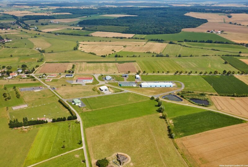
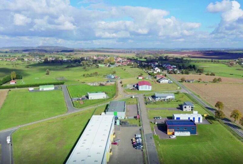
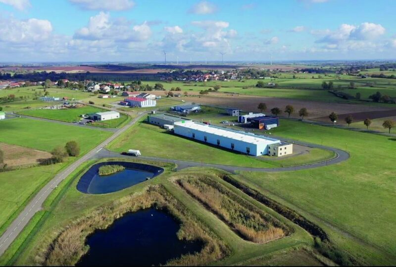
Economic Activity Zone – Francaltroff
Area summary
Services provided
Water
- Drinking water supply by the municipal network depending on the Syndicat des Eaux de Hellimer et Frémestroff and the Syndicat des Eaux de Rodalbe
Electricity
- High voltage supply 20 000 volts
Gas
- No gas supply in the Francaltroff area
Sanitation
- The domestic discharges of the settlements are treated by the sanitation syndicate of LENING FRANCALTROFF
Digital
- Fiber, Very High Speed Internet
Connections
Roads
- RD674 towards SARRE-UNION and A4-E25 freeway towards Strasbourg
- RD674 towards PUTTELANGE AUX LACS then A4-E25 towards Freyming-Merlebach and highway A320-E50 towards Germany
- RD22 towards Saint-Avold then A4-E25 towards Metz/Paris or Strasbourg
Airport
- Regional airport of Metz-Nancy-Lorraine at 51 km
- Luxembourg-Findel International Airport at 125 km
- Strasbourg-Entzheim Airport at 118 km
- Saarbrücken-Ensheim Airport at 60 km
- Frankfurt-Hahn airport 180 km away
Railway
- TGV access to Paris, Lyon, Bordeaux, Lille, Strasbourg, from the stations of Morhange, Metz, Lorraine TGV or Nancy
River
- Ports of Metz (40 km), Thionville-Illange, Strasbourg (110 km)
Further information
Accessibility on site
- Access to the activity zone from the RD22 or the RD79D by an internal road
Studies already carried out
- Preventive archaeology, impact study, environmental assessment, water law study, soil mechanics study, urban planning study
Technical information
- Maximum height of the constructions: 15 m.
- Type of land: public.
- Site listed in the approved land-use plan: no land-use plan in the commune. A subdivision by-law applies.
- Planning procedure: subdivision.
- Site zoning: Rural Regeneration Areas (ZRR).
- Site zoning – benefits in terms of aid or tax/social exemptions: yes.
- Exemption from land development tax: no.
Main companies
- EPSMS / SOCALTRA / UDSR / CIEL EXPERTISES / INNOV’PC / OK PNEU EST (EUROTYRE) / VENAISONS DE LA TENSCH
Localisation
Ou appellez nous directement au +33 (0)3 87 37 57 80